Tectoni Africa Ltd Applied Earth Sciences
Tectoni Africa Ltd
Home About
Services
Core Science SystemsEcosystemsGeology, Energy & MineralsNatural HazardsWater ResourcesSpecialised Civil & Marine WorksAll six mission areas
Work
Project highlightsClients & sectorsVideo & field feed
Coverage
Resources
Engineering toolsApplied Earth Sciences 101Ethics & governanceCareers
Contact
Request a quote
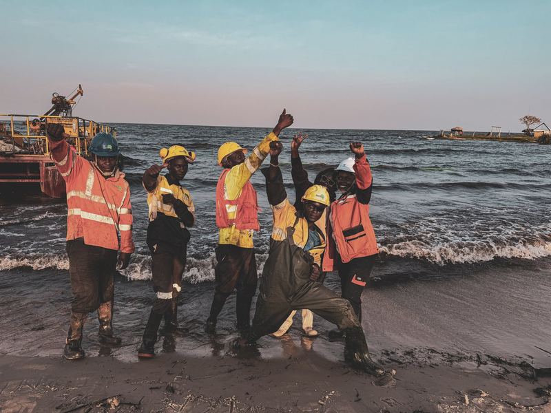
Tectoni Africa crew on the shore of Lake Victoria with an offshore drilling platform behind them

Applied Earth Sciences · East & Central Africa

We make it happen.

We read the ground, prove the materials and de-risk the build. From dam foundations on the Nile to transmission lines across the Great Lakes, our crews turn Africa's toughest sites into certainty you can build on.

17+Years of experience
50,000 mDrilled since founding
500+Major projects delivered
7Countries · work permits held

Log 01 · 0.00–3.20 m · Who we are

The ground is rarely what it looks like from the surface.

Tectoni Africa Ltd was formed in Uganda through the merger of Tectoni and Geotech Solutions (U) Ltd — combining seventeen years of field experience into one applied earth sciences company.

Every dam, port, road, pipeline and power station is only as safe as the ground beneath it, and that ground is hidden, variable and unforgiving of assumptions. We go and find out. On land, in swamp and over open water, we measure the subsurface, prove the materials, quantify the risk and hand designers the verified numbers their work depends on — reported to Eurocode 7, BS 5930 and ISO practice.

Log 02 · Service portfolio

Six mission areas.

Five carry our core applied earth sciences competencies. The sixth turns that science into finished infrastructure — wherever a project needs the ground understood, the water managed, or the risk quantified.

Mission area 01

Core Science Systems

Our primary mapping and geospatial division — the foundation every other mission area builds on. Topographic and geologic mapping, cross-border geodata coordination, drone and satellite remote sensing, 3D and BIM.

What we deliver
Mission area 02

Ecosystems

Science that protects the health, safety and prosperity of people. Impartial environmental information for the continent's hardest land-management questions — on public land, at industrial sites, and in the communities that depend on both.

What we deliver
Mission area 03

Geology, Energy & Minerals

The mission area most clients meet first. Impartial scientific information on the continent's geologic resources and on the construction ground beneath every dam, port and pipeline — from critical minerals to foundation design parameters.

What we deliver
Mission area 04

Natural Hazards

Floods, debris flows, landslides, rockfall, collapses and earthquakes do not wait for preparedness to catch up. We monitor, assess and quantify the full range of natural hazards so that owners, operators and the public can act on numbers rather than fear.

What we deliver
Mission area 05

Water Resources

A large share of Africa's drinking water comes from groundwater. We monitor, assess and deliver information on streamflow, groundwater, water quality and availability — and confront the water dimension of climate change with science-based solutions.

What we deliver
Mission area 06

Specialised Civil & Marine Works

Science tells you what to build; someone still has to build it. This is where Tectonians put on harnesses, wetsuits and welding masks — in-water works, dam and powerhouse maintenance, industrial surface protection and power line construction.

What we deliver
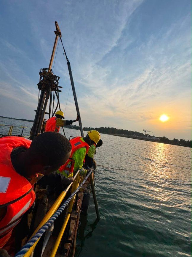
Tectoni over-water drilling platform silhouetted against a red sunset on Lake Victoria

On site · seven countries

From the highlands to the lakebed.

Wherever the ground must be understood, the water managed or the risk quantified — Tectonians are there. On land, in swamps and over open water.

Log 03 · Selected references

Proven in the field.

Dams protected, ports founded, lines energised, pipelines grounded in fact. Twenty-four references from the last eighteen months and the eight years before them — proof, not promises.

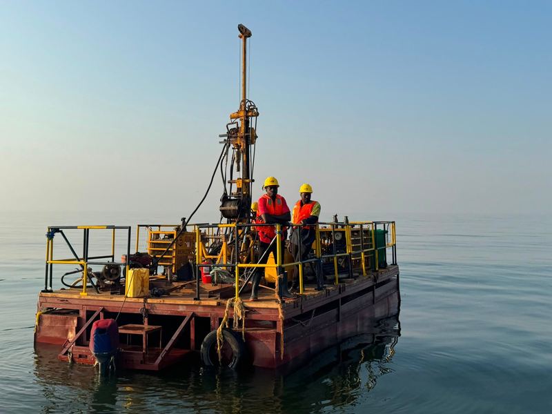
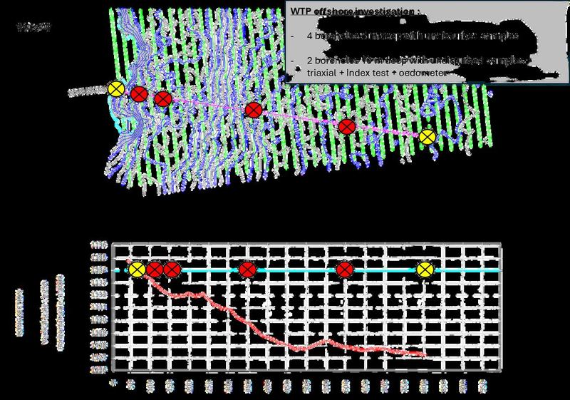
Offshore geotechnical investigation — Bukakata intake, Lake VictoriaJuly 2026

Offshore geotechnical investigation — Bukakata intake, Lake Victoria

Six over-water boreholes along the raw water intake pipeline route (RWPS +50 m to +800 m) from an anchored floating platform on Lake Victoria — rotary drilling, SPT, undi…

Client — SOGEA-SATOM for NWSC / Ministry of Water & Environment

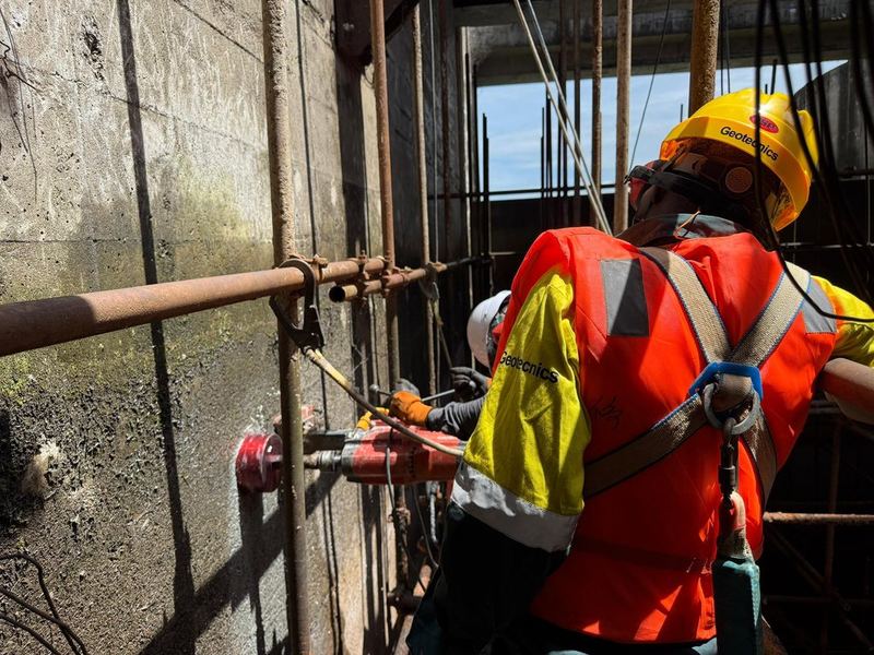
Concrete core extraction and in-situ testing — Isimba HPP spillwayMay 2026

Concrete core extraction and in-situ testing — Isimba HPP spillway

Extraction of 18 concrete cores from the SP1-2 spillway side walls, 150 mm diameter × ~400 mm long, using two-stage drilling to navigate heavy reinforcement at ~291 mm de…

Client — CWE

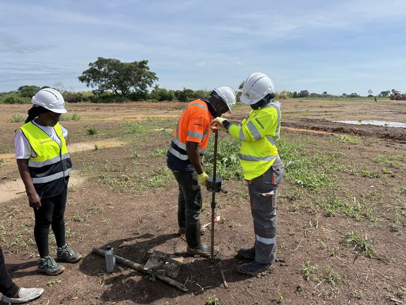
Geotechnical investigation — Mobile Air Traffic Control Tower, Kabaale International AirportApril 2026

Geotechnical investigation — Mobile Air Traffic Control Tower, Kabaale International Airport

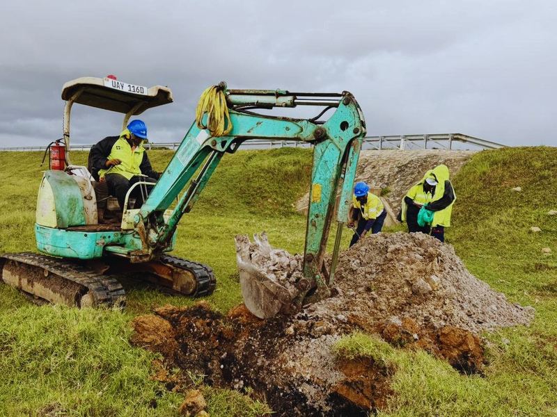
Trial pitting and logging to 3 m, bulk sampling, DPL at three locations to 5 m, and a full laboratory programme to provide foundation design parameters for the new MATCT …

Client — SBI Holdings (sub-contract)

Soil resistivity testing — WTP, IPS, Kako and KitovuMarch 2026

Soil resistivity testing — WTP, IPS, Kako and Kitovu

Resistivity investigation at four sites of the Masaka water supply scheme with a Syscal Pro 48 to ASTM G57-95a, supporting earthing and lightning protection design and co…

Client — SOGEA-SATOM / NWSC

Geotechnical survey — pipe supports and pipe bridge, Bukakata to KitovuMarch–April 2026

Geotechnical survey — pipe supports and pipe bridge, Bukakata to Kitovu

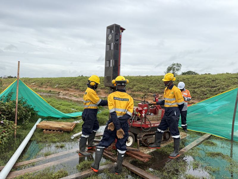
Eighteen boreholes to 10–16 m across three pipe-support sections and one pipe bridge crossing, with SPT, undisturbed sampling, piezometer installation, DPL to 6 m, test p…

Client — SOGEA-SATOM / NWSC

pH and acid reserve investigation — Masaka transmission mainFebruary 2026

pH and acid reserve investigation — Masaka transmission main

Eighty-two trial pits at 3.0 m depth along the full transmission main from Bukakata to Kako and Kako to Kitovu, with 246 soil samples tested for pH and acid reserve to de…

Client — SOGEA-SATOM / NWSC

Log 04 · Watch

Tectoni in motion.

Rigs on barges, crews in galleries, cores coming up out of the ground. Our field feed shows the work as it actually happens — not as a brochure imagines it.

Log 05 · Trusted by

Owners, EPCs and consultants.

Bujagali Energy LimitedHydropower owner · Uganda
CWE — China Int'l Water & ElectricEPC contractor · Isimba HPP
UEGCLUganda Electricity Generation Co.
Fichtner GmbH & Co. KGConsulting engineers · Germany
SOGEA-SATOMEPC contractor · water infrastructure
NWSCNational Water & Sewerage Corporation
KEC InternationalTransmission EPC · India
REGIDESOUtility · Burundi
UNDPUnited Nations Development Programme
Ministry of Water & EnvironmentGovernment of Uganda
Ministry of Works and TransportGovernment of Uganda
GAUFF EngineeringConsulting engineers · Kampala Port
Inyatsi ConstructionContractor · Kabuyanda Dam
SERING IngegneriaConsulting engineers · Italy
SinohydroEPC contractor · hydropower
Eskom UgandaGeneration operator · Kiira & Nalubaale
Log 06 · Client tools

Answers before the quotation.

Free planning tools built from the way we actually scope work. Size an investigation, sanity-check an N-value, classify a soil, or convert your bearing pressure — then send the result straight into a request for quotation.

Tool

Scope builder

Size a ground investigation against your structure, footprint and ground type — boreholes, depth, metreage, laboratory and duration.

Open the builder
Tool

SPT bearing check

Turn an SPT N-value into an indicative allowable bearing pressure with depth and groundwater corrections.

Run the check
Tool

Plasticity classifier

Plot liquid and plastic limits on the Casagrande chart and read the USCS group and swell potential.

Classify a soil
Tool

Resistivity & earthing

Convert a measured resistivity into a corrosivity class and an indicative earth electrode requirement.

Check corrosivity

We make it happen

We read the ground. We de-risk the build.

From dam foundations on the Nile to transmission lines across the Great Lakes, our crews turn Africa's toughest sites into certainty you can build on.