Geotechnical and geophysical investigations for Arua Water Dam in Uganda - Tectoni Africa

A critical component of the Climate Resilience and Water Infrastructure for Refugees and Host Communities in Northern Uganda Program.

Our Clients

We are guided by our commitment to integrity, collaboration, accountability, learning, and excellence in our dealings with each other and with those we support and serve.

Sector
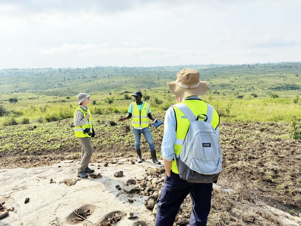
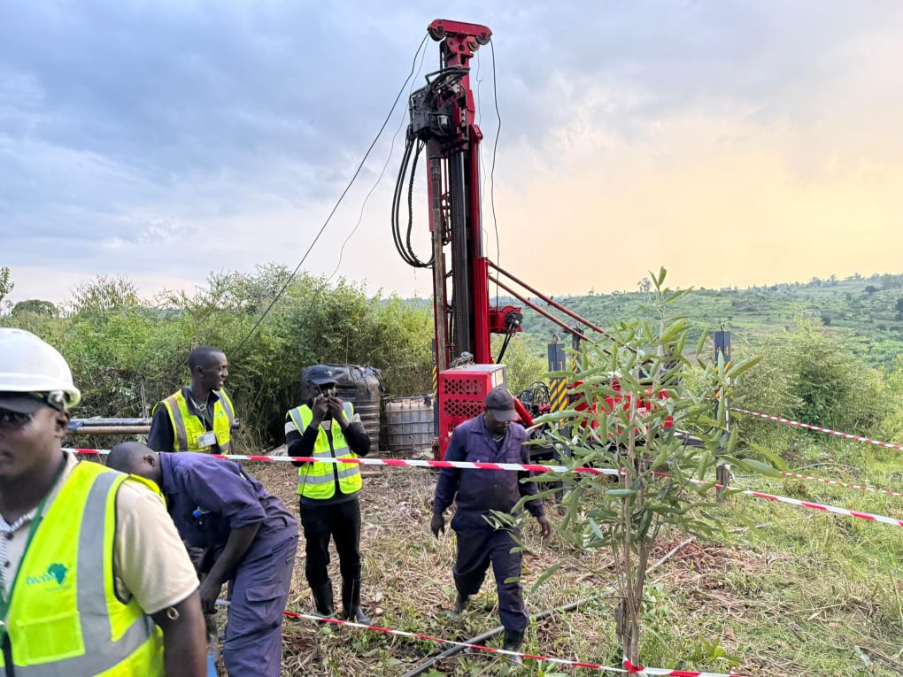
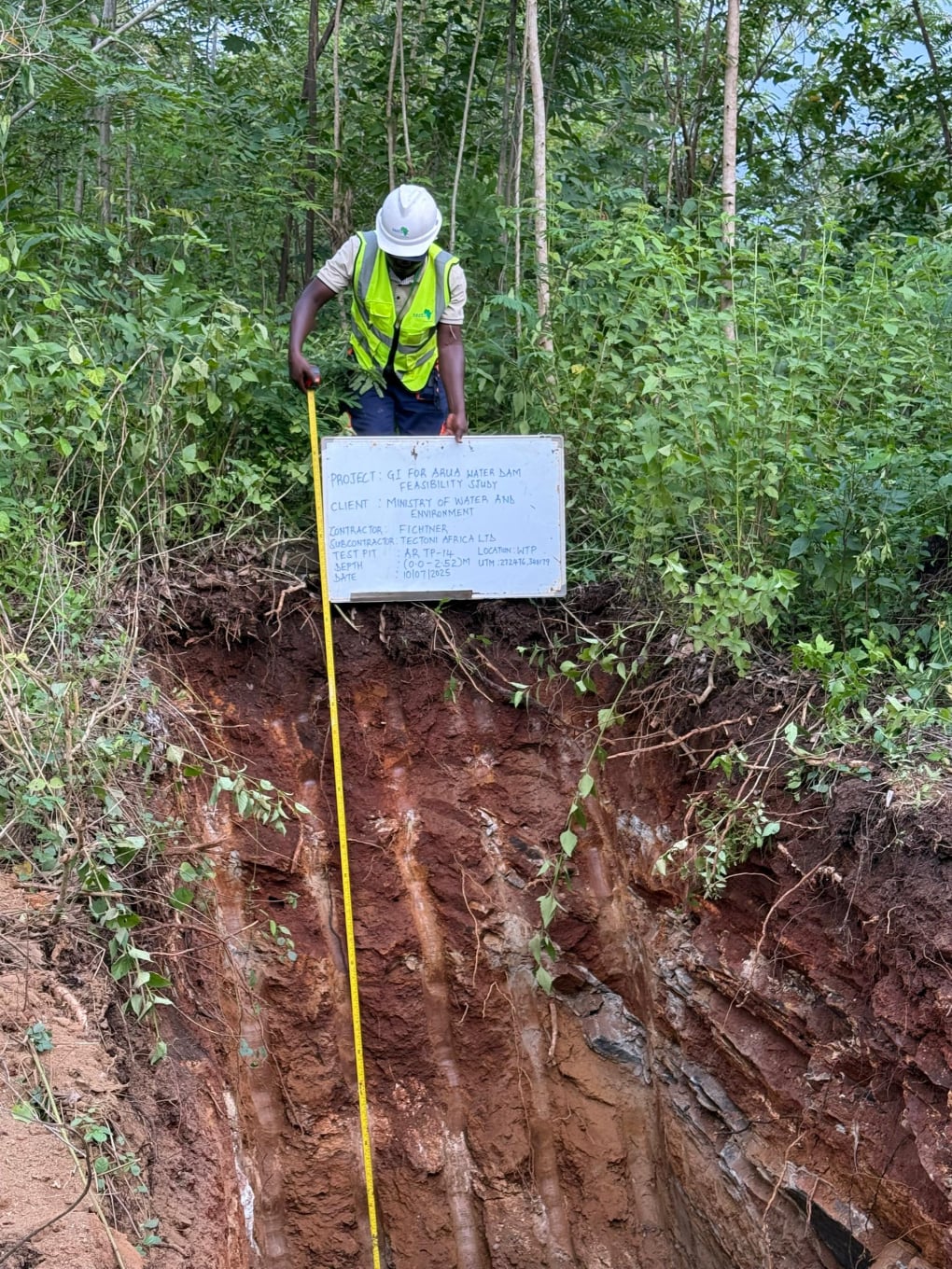
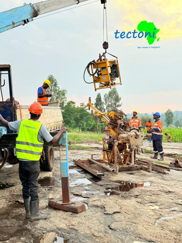
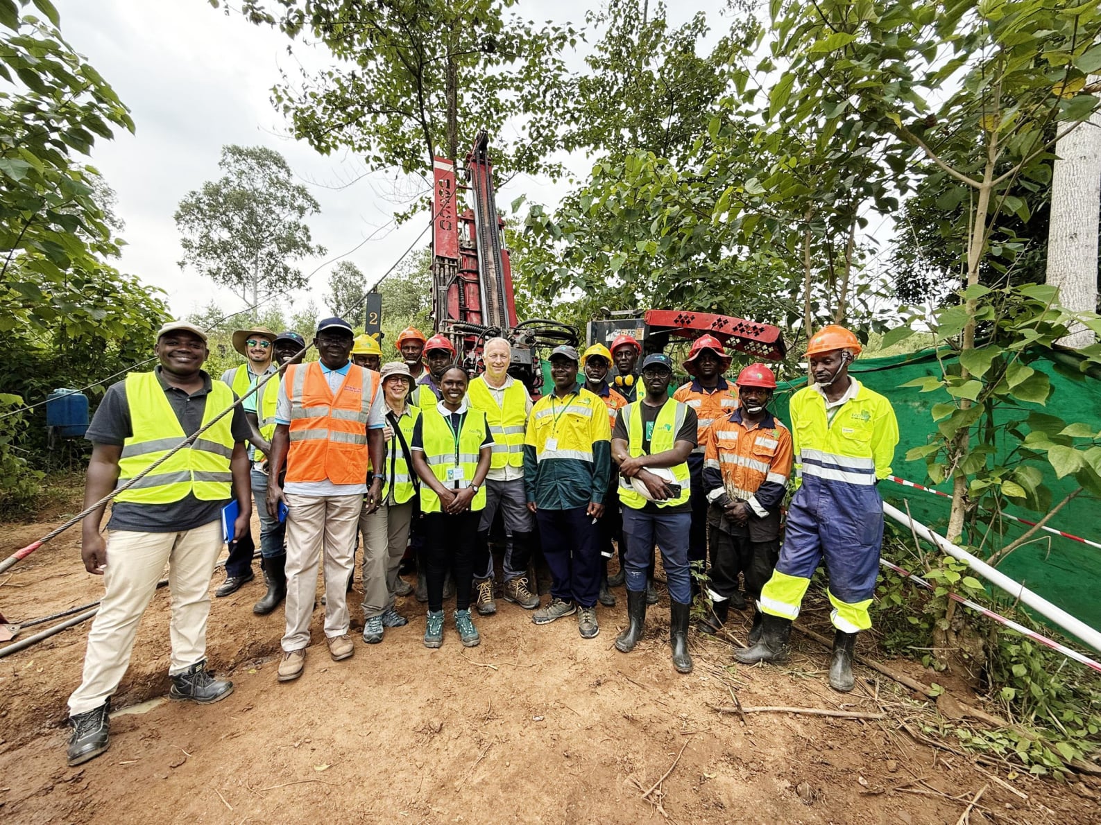
WATER AND ENVIRONMENT
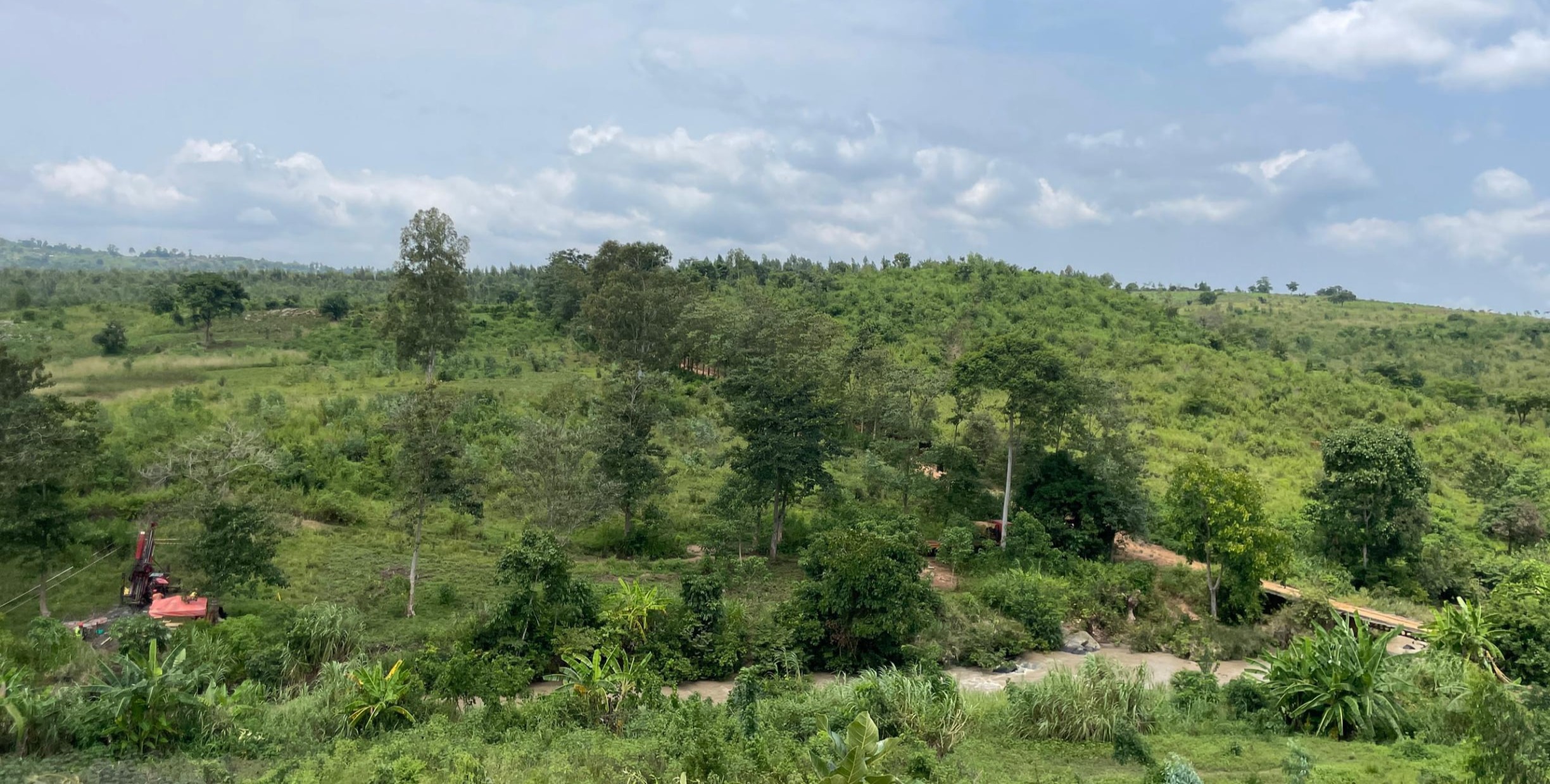
Location:  ARUA
Duration; JULY -AUG 2025

Mobirise Website Builder

Fichtner GmbH & Co. KG

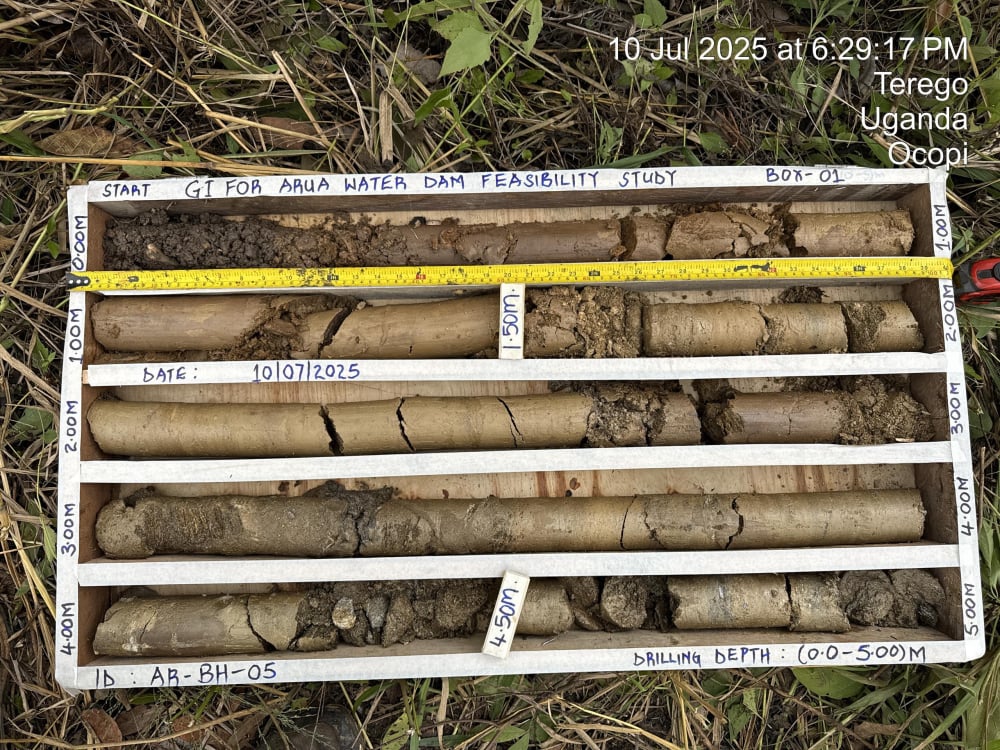
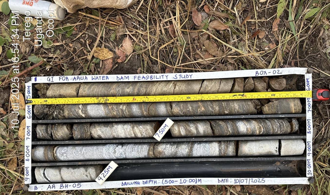
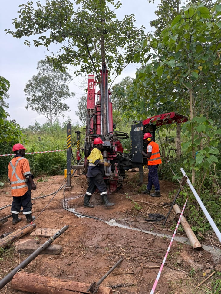
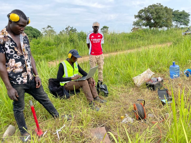
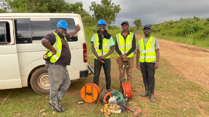
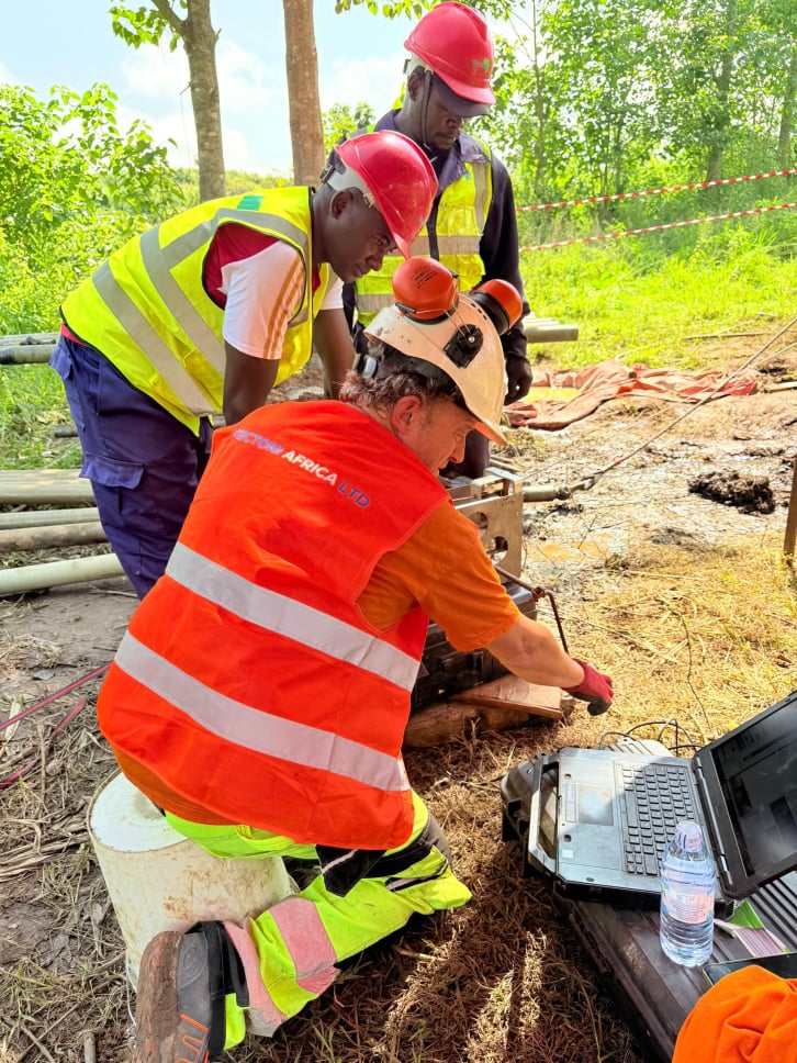
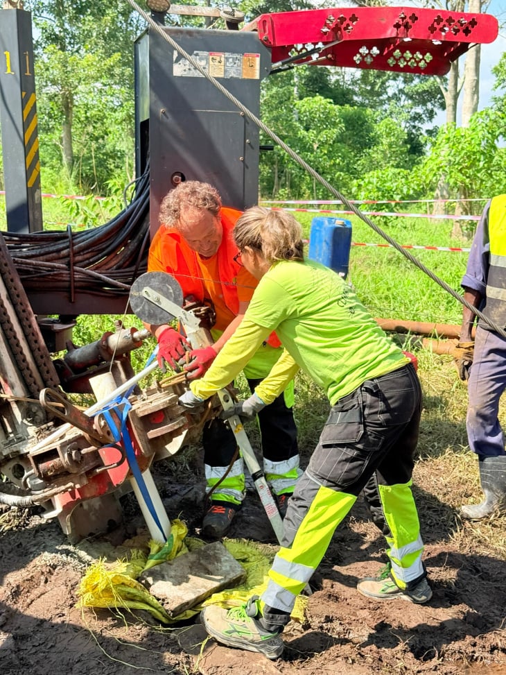
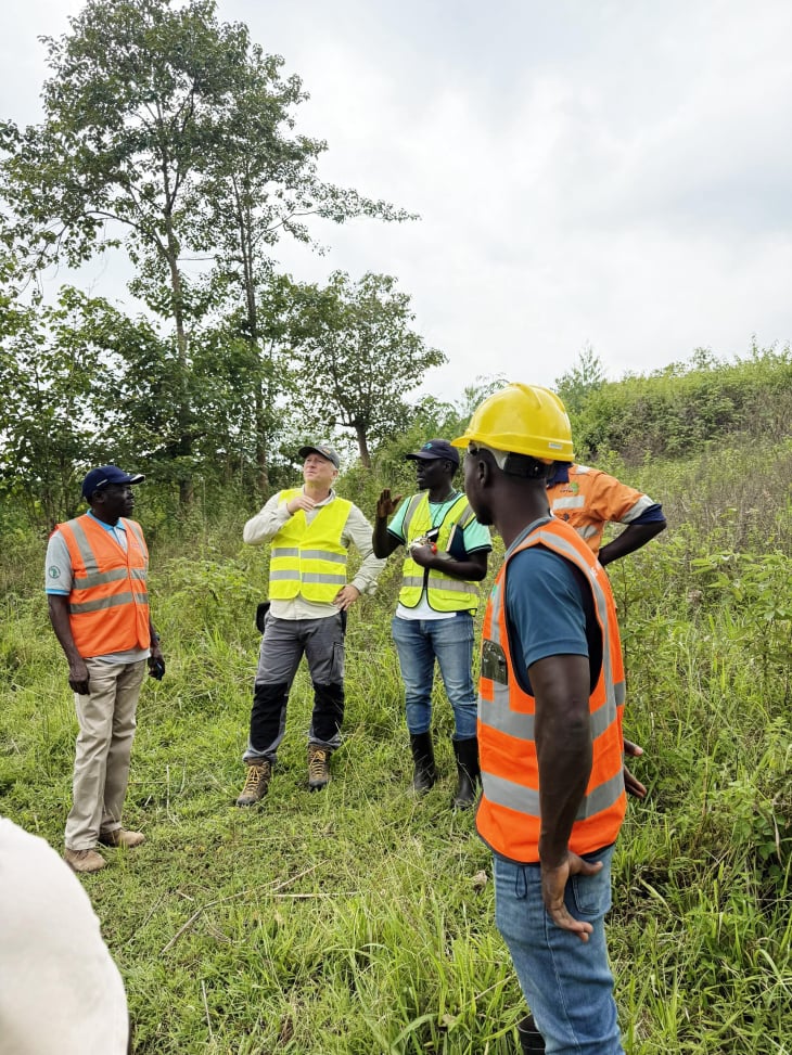
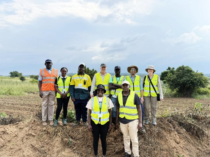
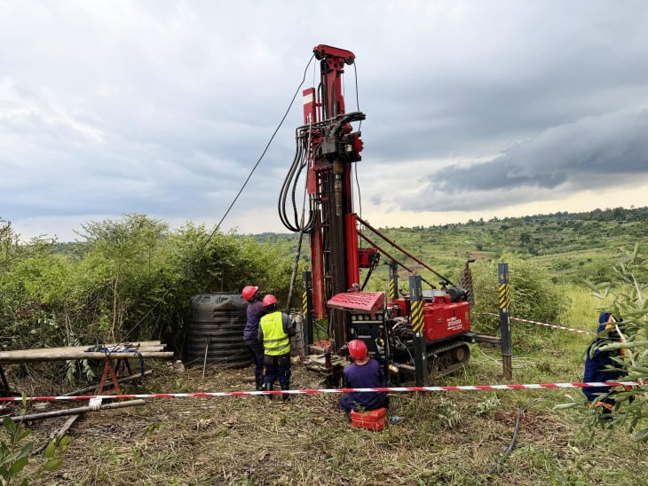
Tectoni Africa Ltd was engaged as a subcontractor by Fichtner GmbH & Co. KG to conduct comprehensive geotechnical and geophysical investigations for the Arua Water Dam Feasibility Study, a critical component of the Climate Resilience and Water Infrastructure for Refugees and Host Communities in Northern Uganda Program.

Mobirise Website Builder

Ministry Of Water and Environment

Funded by KfW and MoWE, this project aims to enhance water infrastructure resilience for refugee and host communities, supporting sustainable socio-economic development in the region.

Mobirise Mobirise
Mobirise

Work Scope

Tectoni Africa Ltd delivered specialized services, including:
•⁠ ⁠Geological Surface Mapping: Covered approximately 5 km² of the dam site and reservoir area to assess geological conditions.
•⁠ ⁠Geotechnical Investigations: Executed borehole drilling, Standard Penetration Tests (SPT), and Acoustic/Optical Televiewer imaging to evaluate subsurface properties.
•⁠ ⁠Geophysical Investigations: Conducted Seismic Refraction Tomography (SRT) to map subsurface structures.
•⁠ ⁠Laboratory Testing: Analyzed soil and rock samples to inform dam design and construction feasibility.
•⁠ ⁠Data Reporting: Compiled a comprehensive report detailing investigation results, ensuring compliance with client specifications and KfW standards.

Mobirise Website Builder
Mobirise
Mobirise

Arua Dam GI with Berretta Alfredo Rig

HQ Diamond rotational drilling

Mobirise

Arua Dam GI with SP3500 Desco Rig

HQ Diamond rotational drilling

Mobirise

Geophysical Investigations

Conducted Seismic Refraction Tomography (SRT) to map subsurface structures.

Mobirise

Geophysical Investigations

Conducted Seismic Refraction Tomography (SRT) to map subsurface structures.

Mobirise

Optical and Acoustical Tests

Partner: Geologgin SPA

Mobirise

Geophysical well logging methods

 can offer essential data and immediate solutions to exploration projects in the oil and gas, mining and geothermal industries, as well as, hydrogeological and civil engineering projects linked to geology and geotechnics

Mobirise

Geological Mapping

Covered approximately 5 km² of the dam site and reservoir area to assess geological conditions.

Mobirise

Geological Surface Mapping

Covered approximately 5 km² of the dam site and reservoir area to assess geological conditions.

  • 0772788632
  • j.lubega@tectoni.com

tectonia

© Copyright 2030 Tectonia - All Rights Reserved